
USA-The Chicago area and surrounding communities are expected to see additional snowfall from Tuesday night into Wednesday, followed by an Arctic blast that will bring dangerously cold temperatures across the Midwest.
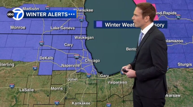
Weather officials have issued a Winter Weather Advisory for several counties in Illinois, including Cook, DuPage, Lake, McHenry, DeKalb, Kane, and Boone. The advisory is in effect from 10 p.m. Tuesday until 8 a.m. Wednesday. Similar advisories are also in place for parts of Wisconsin and Michigan during roughly the same time period.
Forecasts indicate that the highest snow totals are expected near and north of Interstates 88 and 290. Northern Chicago suburbs could see more than four inches of snow, while areas farther south are expected to receive two inches or less.
ABC7 Chicago meteorologist Larry Mowry said lingering snow could impact the Wednesday morning commute, creating slippery road conditions and reduced visibility, particularly during the early hours.
Temperatures on Wednesday are expected to be relatively milder, with highs in the upper 20s to near 30 degrees Fahrenheit. However, another round of scattered snow showers is possible Wednesday evening as an Arctic cold front moves into the region.
Conditions will turn significantly colder on Thursday, with high temperatures struggling to reach 20 degrees. The coldest air is expected to arrive Thursday night into Friday morning.
By Friday morning, wind chills could drop as low as minus 35 degrees Fahrenheit, and daytime high temperatures may remain below zero. The extreme cold is expected to persist into Saturday, with below-average temperatures likely for the remainder of the month.
Sumber Berita: www.abc7chicago.com